CONSTRUCTION
Full House Visualizer
A complete virtual selling solution.

EAGLEVIEW DATA
Introducing SolarReady™
Expand your business by quickly identifying residential properties suitable for solar.

EAGLEVIEW DATA
Integrate EagleView Data into your Platform
Developers – Access the resources and tools you need to build, test, and launch effective solutions.

INSURANCE
EagleView + Betterview for Disaster Response
Helping Property and Casualty Insurers better manage and respond to large-scale events.

GOVERNMENT
EagleView Cloud
See with Clarity.
Decide with Confidence.

Number One for a Reason
Industry leaders trust EagleView to deliver, each and every time.
1B
Images in Our Database
9.5M
Miles Flown Per Year
300+
Patents and Counting
The Clearest Imagery and Property Data Available
Gain a Competitive Edge
- 20 years proven experience providing the highest resolution imagery
- 4x more detailed than standard aerial imagery
- 70x more detailed than standard satellite imagery
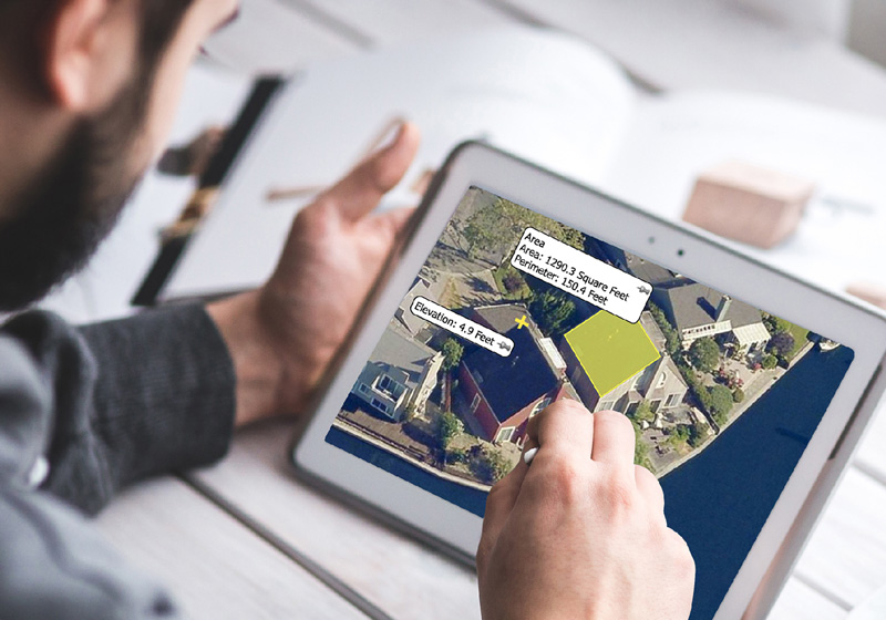
- Building measurements to the ninth decimal point
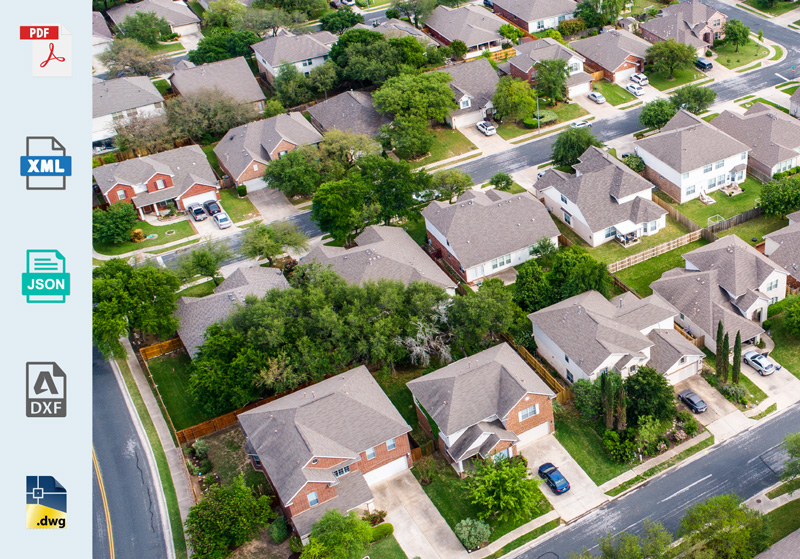
Versatile file types for your adaptable business
- Get reports in PDF, XML, JSON and DXF formats at any time
- Import directly into third party integrations and industry workflows
Our Products
Get the best geospatial data on the market – in any format
Reveal™ Imagery
Oblique to orthogonal. Mosaics to patented high-res. We have the imagery to meet your needs in an ever changing world.


Property Data
Reduce costs, minimize labor safety risks, and increase profitability. Get ultra-detailed contextual roof information.
Assess™
Virtual inspections with autonomous drones and damage detection software. Resolving claims with greater efficiency and accuracy.

Why Choose EagleView?
For more than a decade, EagleView has been the gold standard for accurate property measurement data.
Learn MoreReal Customers,
Real Results

Jodi Amato
Assessor
“EagleView’s imagery gets used daily in our office… A picture is priceless when they tell us that there’s vacant land and we can clearly see that there are three to four structures on it.”


